Exploring the Twin Cities bike trails is one of the best ways to experience the great outdoors. Whether you’re looking for a leisurely ride or an adrenaline-filled adventure, the Minneapolis and St. Paul metro area has it all. From Bde Maka Ska to West River Parkway, Minnesota’s bike trails offer something for everyone.
In this blog article, we’ll explore the best Twin Cities bike trails and share some pro tips for making the most of your Minneapolis and St. Paul cycling adventures.
Introduction to the Twin Cities Bike Trails
The Twin Cities of Minneapolis and St. Paul are home to an amazing network of bike paths and bike lanes, making it easy to explore the great outdoors. Whether you’re looking for a leisurely ride around the Chain of Lakes or an adrenaline-filled mountain biking adventure, there’s a trail for you.
From the lush greenways along the Mississippi River to the winding trails through the woods, the Twin Cities have an incredible variety of scenery. There are dozens of state trails, as well as some of the best places to ride in Minnesota.
Minneapolis has over 145 miles of on- and off-street bikeways, including over 35 miles of off-street paved trails. And St. Paul has more than 60 miles of on- and off-street bikeways, with nearly 30 miles of paved trails within city parks along the river valley.
Furthermore, there are several regional parks that are connected via bike trails within the Twin Cities metro area. The Cedar Grove Trail connects Cedar Grove Park in Maplewood with Hazel Park in Oakdale, and is part of the larger Mississippi River Regional Trail system. And the Mississippi Regional River Trail connects 10 communities along the Mississippi River from Hastings in the west to Red Wing in the east.
These bike trails even connect you to other cities around Minnesota—you can connect with Rochester’s Riverbank Trail System, or head north to Duluth’s extensive trail system, or head south to Mankato’s Capital City Bike Trail System.
In this blog post, we’ll examine some of the top Twin Cities bike trails and offer some insider advice for maximizing your cycling excursions in Minneapolis and St. Paul.
Twin Cities’ Best Bike Trails by Types
If you’re looking for an adventure in the Twin Cities, exploring on two wheels is the way to go. From mountain biking and road biking to cycling for all levels and families, St. Paul and the surrounding metro area have a variety of bike trails to explore. Whether you’re a beginner or an experienced cyclist, there’s something for everyone. In this guide, we’ll explore the best bike trails in and around St. Paul. So get ready to hit the trails and explore the best of the Twin Cities on two wheels!
Best Places for a Bike Ride in the Twin Cities
When it comes to biking in the Twin Cities, there are plenty of great places to explore. The best places for a bike ride in St. Paul include the Chain of Lakes, Cedar Lake, Theodore Wirth Park, and Itasca State Park. For those looking for a challenge, there are plenty of unpaved trails in the area. The Chain of Lakes is a great place for road bikers and families, while Cedar Lake has plenty of trails for mountain bikers. Theodore Wirth Park is a great place to explore with miles of trails and plenty of wooded areas. For a more remote experience, check out Itasca State Park, which has miles of trails and plenty of wildlife.
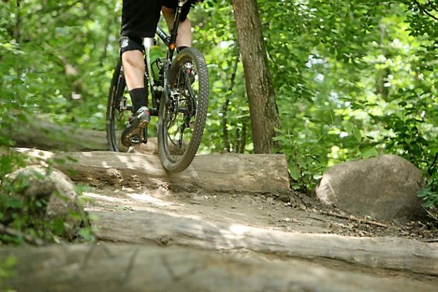
Best Bike Trails for Mountain Bikers
If you’re a mountain biker, the Twin Cities have plenty of trails to explore. The best trails for mountain bikers include the Wooded Areas of County Road 5, the Cedar Lake Trail, and the Brown’s Creek State Trail. The Wooded Areas of County Road 5 are great for experienced mountain bikers looking for some challenging terrain. The Cedar Lake Trail is a great place to explore with plenty of trails and scenic views. Finally, the Brown’s Creek State Trail is perfect for mountain bikers of all levels and offers a great mix of terrain and scenery.
Best Bike Trails for Road Bikers
For road bikers, the Twin Cities offer a great selection of trails. The best trails for road bikers include the Bde Maka Ska, the Luce Line State Trail, the Lake of the Isles, and the St. Croix River. The Bde Maka Ska is a great place for a leisurely ride with plenty of scenic views. The Luce Line State Trail is perfect for road bikers looking for some challenging terrain. The Lake of the Isles is a great place for a peaceful ride, while the St. Croix River is perfect for those looking for a more remote experience.
Best Bike Trails for Cyclists of All Levels
For those looking for a more leisurely ride, the Twin Cities offer plenty of bike trails for all levels. The best trails for cyclists of all levels include the Medicine Lake Regional Trail, the Midtown Greenway, and the Theodore Wirth Park. The Medicine Lake Regional Trail is perfect for a leisurely ride with plenty of scenic views. The Midtown Greenway is great for cyclists of all levels with plenty of trails and bike paths. Finally, Theodore Wirth Park is perfect for cyclists of all levels and offers a great mix of terrain and scenery.
Best Bike Trails for Families
For those looking to explore the Twin Cities with their family, there are plenty of great trails to explore. The best trails for families include the Cedar Lake Trail, the Midtown Greenway, and the Theodore Wirth Park. The Cedar Lake Trail is perfect for families with plenty of trails and scenic views. The Midtown Greenway is great for families with plenty of trails and bike paths. Finally, Theodore Wirth Park is perfect for families with a mix of terrain and scenery.
Best Bike Trails for Nature Lovers
For those looking to explore the great outdoors, the Twin Cities offer plenty of bike trails for nature lovers. The best trails for nature lovers include the Cedar Lake Trail, the Luce Line State Trail, and the St. Croix River. The Cedar Lake Trail is perfect for nature lovers with plenty of trails and scenic views. The Luce Line State Trail is great for nature lovers with plenty of trails and bike paths. Finally, the St. Croix River is perfect for nature lovers with a mix of terrain and scenery.
Bike Trails Near St. Paul
For those looking to explore the trails near St. Paul, there are plenty of great places to explore. The best trails near St. Paul include the Itasca State Park, the Cedar Lake Trail, and the Midtown Greenway. The Itasca State Park is perfect for those looking for a more remote experience with plenty of trails and wildlife. The Cedar Lake Trail is great for mountain bikers and families with plenty of trails and scenic views. Finally, the Midtown Greenway is perfect for cyclists of all levels with plenty of trails and bike paths.
Bike Trails Near Minneapolis
For those looking to explore the trails near Minneapolis, there are plenty of great places to explore. The best trails near Minneapolis include the Theodore Wirth Park, the Luce Line State Trail, and the Bde Maka Ska. The Theodore Wirth Park is perfect for families with a mix of terrain and scenery. The Luce Line State Trail is great for road bikers and nature lovers with plenty of trails and bike paths. Finally, the Bde Maka Ska is perfect for a leisurely ride with plenty of scenic views.
Best Bike Trails Around Minnesota Rivers
If you’re looking for a more remote experience, the Minnesota rivers offer plenty of great trails to explore. The best trails around Minnesota rivers include the St. Croix River, the Mississippi River, and the Minnesota River. The St. Croix River is perfect for nature lovers with a mix of terrain and scenery. The Mississippi River is great for road bikers and families with plenty of trails and bike paths. Finally, the Minnesota River is perfect for a leisurely ride with plenty of scenic views.
Favorite Trails Around the Twin Cities
If you’re looking for a great place to explore the Twin Cities bike trails, there are a few that stand out.
The Cedar Lake Trail is a great place to start. This multi-use trail runs from downtown Minneapolis to the Chain of Lakes and is a great place to take in the sights of the city.
The Midtown Greenway is a great place to explore the city. This multi-use trail runs from Uptown to Theodore Wirth Park and is a great place to take in the sights of the city.
The Luce Line State Trail is a great place to explore the Minnesota countryside. This trail runs from Plymouth to Cosmos and is a great place to explore the Minnesota countryside.
The Itasca State Park is a fantastic location for forest exploration. This park is located in northern Minnesota and is home to miles of trails, lakes, and wooded areas.
The West River Parkway is a great place to explore the great outdoors. This trail runs from Lake Street in Minneapolis to Theodore Wirth Park in Golden Valley and is a great place to explore the Minnesota countryside.
Let’s have a closer look.
Grand Rounds Scenic Byway

The Grand Rounds is a series of parks and trails that circle the Twin Cities and is one of the most popular bike trails in the area. The Grand Rounds offers more than 100 miles of paved trails that wind through wooded parks, lakes, and natural areas. This trail is perfect for a leisurely weekend ride or for commuting to work or running errands.
The trails are marked with a green “GR” logo and maps are available at many bike shops and city recreation centers. Some of the most popular segments include:
Theodore Wirth Park is one of the largest parks in the Twin Cities metro area and features more than 22 miles of paved trails along Lake Phalen. You can even bike to the St. Paul Fish Hatchery on the connected Fish Hatchery Trail.
Shoreview Park is a smaller park just north of downtown Minneapolis but is home to almost 10 miles of beautiful paved trails that circle two lakes, Lake Phalen and Lake Elmo. The lake trail runs along the edge of each lake and has beautiful views of the water. And you can even bike on an old railroad trestle bridge over the Mississippi River!
The Grand Rounds Scenic Byway is a paved, mostly car-free loop around Minneapolis and St. Paul. The trail system takes cyclists through some of the Twin Cities’ most beautiful parks and nature sanctuaries. Cyclists can either take the entire byway in one ride (a ride which will take about three hours) or pick and choose their own ride based on what interests them.
When choosing a trail, you can use the map on the Grand Rounds website to plan your route. Be sure to hit up the Minnehaha Falls, Theodore Wirth Park, Phalen Park and Fort Snelling State Park. You can also pick up the Mississippi River Trail (which runs right along the river) at Fort Snelling State Park, and take it north to visit the “Mighty” falls, then take the Como-Harriet Streetcar Trail back to the Grand Rounds.
The Grand Rounds Scenic Byway is open all year, but during winter months there will be fewer trails open (as some bike trails are plowed over). In summer months, construction may temporarily close some trails along this route.
Minnehaha Parkway

Minnehaha Parkway is part of the Mississippi National River and Recreation Area, which encompasses over 13,000 acres along the Mississippi River. The parkway runs along the Mississippi River, offering views of the water. It’s a beautiful trail, dotted with linden trees, benches, and picnic tables. You’ll also find the ruins of an old house on the grounds that are said to be haunted by ghosts.
The Minnehaha Parkway connects with three other popular trails: Theodore Wirth Park, Lyndale Park Bikeway, and Cedar Lake Trail. So you can easily tack on several extra miles to your ride and explore more of Minneapolis and its bike trails.
The trail is paved, but be warned—there aren’t any bike lanes. Cars often speed along this road since it’s a main thoroughfare to and from Downtown Minneapolis. There are some designated parking lots for bikers along the Minnehaha Parkway—again, though, they are metered.
The park is open from 5 am to 10 pm daily. Parking is free in the lot at Lake Street and Minnehaha Parkway during non-peak hours; however, during peak hours (7 am to 9 am and 4 pm to 6 pm), you’ll need to pay $.
Midtown Greenway

The Midtown Greenway is a marvel of urban engineering. It’s a former rail corridor that has been transformed into a tree-lined bike path, running from the downtowns of Minneapolis and St. Paul for over 12 miles. One of the most popular sections of the Greenway is the 2-mile stretch that runs through the University of Minnesota campus in Minneapolis.
This section is heavily used by University of Minnesota students and offers great views of the campus and the Mississippi River, with plenty of benches for resting along the way. The trail also features artwork and historical markers, demonstrating how it helps preserve important pieces of Minnesota history.
Toward the St. Paul side, you will also pass by a scenic overlook—the West River Parkway overlook—that offers amazing views of downtown St. Paul and the river valley. You can also take a short detour to see one of Minnesota’s 10 “Mighty” falls: Great Falls, which is on the eastern side of St. Paul along this section of trail.
The Midtown Greenway is a fantastic, and largely flat route that runs through the heart of the Twin Cities and connects several other trails, including the Southwest LRT Trail, Cedar Lake Trail, and the Stone Arch Bridge.
This 10-mile trail is so popular it’s even mentioned in a line in the classic Prince song “Purple Rain:” “On the Greenway, walking with my baby…”
The bike trail runs along an old railroad corridor that was converted into a linear park in 1994. Today it features beautiful trails, artwork, and public art installations. The Midtown Greenway is also part of the larger regional Hiawatha LRT Trail system that reaches across Minneapolis.
The trail even has a few unexpected perks: On your ride, you may spot floating houses—adorable homes that were built atop pontoon rafts and floated down the Mississippi River to their current location. And if you’re lucky, you might even spot an ice castle! The Ice Castle, an elaborate structure made completely of ice blocks, is built each year along the Midtown Greenway near Cedar Lake.
You may also want to stop for a bite to eat or a drink on your ride. The Greenway is lined with eateries and coffee shops from north to south—everything from pizza places and sandwich shops to upscale restaurants and coffee houses.
Cedar Lake Trail

The Cedar Lake Trail is a beautiful, paved trail that runs along the east side of Cedar Lake in Bloomington, Minnesota. It’s a little over 3 miles from the eastern edge of the lake (near Normandale Park) to the western edge of the lake (at Cedar Lake Park). The trail is a great place for bikers, walkers, and runners. There are several benches along the way and lots of shade trees.
Cedar Lake Park has a large grassy area, benches, and public restrooms. There’s also a small sandy beach on one end of the lake. In warmer months, there are many swimmers who bask in the sun in this shallow part of the lake.
The trail is smooth and flat, with only a slight incline near the end as you approach Cedar Lake Park. It’s a popular biking trail—especially on weekends—so be prepared to share the path with other bikers and walkers. And if it’s too crowded for your taste, you can always hop off the trail at any point and bike along the side streets to get to your destination.
There are many access points to the Cedar Lake Trail—both in Bloomington as well as in neighboring suburbs like Edina and Richfield: Normandale Park, Breck School, Cedar Lake Park, and more. It’s a great way to explore the area and take in the beauty of Cedar Lake.
The Cedar Lake Trail provides a wonderful opportunity to explore the beauty of Bloomington and the surrounding suburbs. It is a 3-mile paved trail that runs along the east side of Cedar Lake, from Normandale Park on the eastern edge to Cedar Lake Park on the western edge. While biking, walking, or running, visitors can enjoy benches with lots of shade trees along the way.
At Cedar Lake Park, there is a grassy area with benches and public restrooms. There is also a small sandy beach at one end of the lake, which is popular for swimming and sunbathing in the warmer months. The trail has a slight incline near the end but is otherwise smooth and flat. It is popular among bikers, so be prepared to share the path with others. If it gets too crowded, there are many access points off of side streets to get to your destination. These access points can be found in Bloomington as well as nearby suburbs like Edina and Richfield.
Mississippi River Trail
The Mississippi River Trail is a bike and walking path that stretches for 13 miles, connecting the cities of Minneapolis and St. Paul. It mostly follows the Mississippi River, with a few detours through parks and greenways.
The trail starts in downtown Minneapolis at Father Hennepin Bluff Park, where you’ll find a nice place to park your bike and grab a bite to eat before you hit the trail. The trail leads down to scenic Lake Street, which offers more restaurants, shopping, and sightseeing opportunities.
The trail heads south toward downtown St. Paul. You’ll pass Harriet Island Regional Park and the St. Paul RiverCentre before arriving at Mears Park in downtown St. Paul for a chance to stretch your legs and refuel with a bite to eat.
Mears Park sits right along the mighty Mississippi River, so it’s a great place to view the “Mighty” falls from close up. The park also features walking and hiking trails that take you to the base of the falls for up-close views and photo ops.
When you’re done exploring Mears Park and the falls, head back to the Mississippi River Trail and continue your ride along the river through Rice Park in downtown St. Paul before returning to Minneapolis via Washington Avenue or by heading along E. 5th Street in downtown St. Paul.
Riverfront Regional Park
This beautiful 12-mile stretch of trails runs along the Mississippi River in central St. Paul and offers some stunning views. The trails here are mostly flat and well-maintained. The entire trail is open to all non-motorized traffic, including walkers, runners, rollerbladers, and cyclists.
The trails here include the Great River Bluffs and Phalen Park sections. These sections of the trail are more urban affairs, with concrete paths that are heavily trafficked by walkers, runners, and bikers. The Great River Bluffs section features a paved loop around a large park that’s popular for kite-flying and picnicking. It also features an overlook with scenic views of the Mississippi.
The Phalen Park section features a wide gravel path that runs along the river and includes separate lanes for runners and cyclists. This section is more natural and rural in character, with beautiful scenery along the river’s edge. The path passes through wooded areas, open farm country, and residential neighborhoods along the river valley.
The River Valley Trail
The St. Paul river valley is a natural wonderland for outdoor activities and sports. The Mississippi River meanders through this area, creating a river valley with many parks and trails along its edges.
The 12-mile East River Road Bike Trail is one of the most popular bike trails in the area. It winds along the river valley and connects several parks, including Phalen Park, Lexington Park, and Como Park. It’s a mostly flat trail, with the exception of a few small hills.
A variety of things to do can be found along the way, including golf courses, picnic areas, hiking trails, and more. You can even take a break at the Como Park Zoo or the Conservatory to take in some nature or see some exotic plants and animals. There are also many restaurants that line Como Avenue if you’re looking for a place to stop for a bite to eat.
The route can be traveled in either direction, but it’s helpful to go with the flow of traffic when biking on roads with oncoming drivers.
The Lake Harriet Bicycle Trail
The Lake Harriet Bicycle Trail is a 2.5-mile paved trail that runs around Lake Harriet in south Minneapolis. The lake is one of the largest lakes in Minneapolis and features a variety of recreational opportunities, including boating, swimming, and fishing. The trail can be accessed by multiple points around the lake, and there are parking lots at most of them.
The stone-dust path is wide and flat—perfect for the whole family. There are two bridges over the lake that allow the trail to cross to the other side without having to ride on city streets. And don’t worry, you’ll see plenty of wildlife while you’re there—Lake Harriet attracts dozens of species of birds every year.
You can also enjoy other amenities, such as picnic areas with grills and playgrounds right next to the trail. Distances are marked along the route for runners and bikers. And don’t forget about the Harriet Island Pavilion, which is open year-round for public use, including weddings and special events.
The West River Trail
If you’re looking for a place to bike in the Twin Cities, look no further than the West River Parkway Trail, which runs along the Mississippi River. This paved trail is an urban oasis with beautiful parks and sights along the river. The trail runs from Fort Snelling State Park in Minneapolis to Rockford Park in St. Paul and is maintained by the Minnesota Department of Natural Resources.
The scenic West River Parkway Trail is a great place for a leisurely bike ride, or if you’re new to biking, it’s a good place to start. The entire route is about 20 miles long and is relatively flat, making it an ideal bike trail for cyclists of all levels—from beginner to advanced bikers.
The trail has many access points, so you can choose a section that suits your riding level and preferences. Some sections of the trail feature more amenities such as restrooms and water fountains, while other sections are more secluded with fewer people. Additionally, you’ll find that some sections are marked more frequently with signs and barriers to keep cyclists safe from oncoming traffic or cars entering/exiting from driveways.
The Minneapolis Bicycle and Pedestrian Paths
Minneapolis has some terrific bike trails, too. The Mississippi River trails are a popular choice for recreational cyclists and commuters alike. The Cedar Lake Trail runs from downtown Minneapolis to the western suburb of Minnetonka and connects all of the lakes in between.
Another popular route is the Midtown Greenway. It’s a converted railway line that runs along the northern edge of downtown Minneapolis and also connects to several other paths that run through Minneapolis, including the Kenilworth Trail, which runs along the banks of the Mississippi River.
If you’re looking for a more rural experience, try the Theodore Wirth trails in Northeast Minneapolis. These trails are a little more difficult to navigate, as they criss-cross each other and can be a bit confusing, but they take you through beautiful wooded areas with abundant wildlife.
Theodore Wirth Park also features paved trails that are wheelchair accessible and are great for strollers or cycling with kids. The park features seven miles of paved trails that meander through woods, wetlands and lakes.
The Great River Trail
The Riverfront Park in downtown Minneapolis is home to the Great River Trail, which stretches over 12 miles from the suburb of Plymouth down to the Chain of Lakes in south Minneapolis.
While most of the trail is on paved asphalt, there are some sections that are on grass and dirt. If you’re just starting out as a bike commuter or avid recreational biker, we recommend sticking to the asphalt sections.
The trail starts at the Stone Arch Bridge and heads north, along the Mississippi River, through Nicollet Island Park. From here, the trail crosses a few bridges and you’ll eventually hit Mill Ruins Park, which is a historic site with ruins from a flour mill that burned down in 1881.
The trail then crosses over to Fort Snelling State Park and continues along the riverfront until it hits Theodore Wirth Park. Wirth Park has many parks within its system and features trails that connect to the Gateway Parks trails at Theodore Wirth Golf Course.
From here, you have two options to return back to Plymouth where the Great River Trail ends. The first is using Metro Transit’s Route 76 bus, which travels from downtown Minneapolis to downtown St. Paul and makes stops along the trail in both directions. Or if you want to continue biking from here to St. Paul, continue on to learn about the Midtown Greenway below!
Minneapolis Scenic Pathways
Minneapolis is a bike lover’s dream city. Here, you can find a wide range of trails—everything from biking through the heart of the city to an off-roading experience in the woods.
The Minneapolis Scenic Pathway is an eight-mile route that circles the center of Minneapolis. It meanders past public art and pretty views of the Mississippi River, as well as through residential neighborhoods. You can access this trail at various points, including Father Hennepin Bluff Park.
You can also follow this trail north to visit Mill Ruins Park and Stone Arch Bridge, which crosses over the Mississippi River. The Stone Arch Bridge is a historic bridge built in 1883 and was one of the first structures to connect Minneapolis and St. Paul via bridge. This landmark was named after David Dayton, who was a mill owner and sawmill operator—hence its name, Mill Ruins Park.
Mill Ruins Park features picnic areas, playgrounds, restrooms and more. The park is open from 6 a.m.–10 p.m., though the Stone Arch Bridge closes at dusk (roughly around 8 p.m.).
You can access Mill Ruins Park via two different trailheads: The northern entrance trailhead is located at 200 South 2nd Street in downtown Minneapolis; the southern entrance trailhead is located on West University Avenue at East River Parkway in Minneapolis (this entrance also provides access to the Midtown Greenway).
Shingle Creek Regional Trail
The Shingle Creek Regional Trail is a 14-mile paved path that runs along the scenic Shingle Creek and Lake Phalen, in the southeastern suburbs of St. Paul. The trail is an excellent place to view wildlife, including songbirds, waterfowl, and deer, as well as a stunning landscape of hardwood forests, wetlands, and prairies.
The trail has a few access points in St. Paul, including the Highland Park Gymnatorium and Phalen Park. You can also access the trail from the Mississippi River Trail at Fort Snelling State Park or at the Phalen Regional Park.
In St. Paul, there are also several spurs off of the trail that connect it to other major trails in the city. The Westview Spur connects to the Iron Horse Regional Trail and goes into Maplewood and Oakdale. The Highland Spur runs 3 miles along Phalen Boulevard to Highland Park High School and connects to the Como Regional Park trails. And lastly, the Long Lake Spur runs 1 mile along Concord Parkway to Long Lake Regional Park.
This paved trail is a little less than three miles long and runs along Fort Road in the southwest metro area. It is part of the larger Southwest Regional Trail, which will eventually run for more than 100 miles in several counties southwest of the Twin Cities when completed.
The trail is a nice place to run into people jogging, walking their dogs, or walking to a nearby business. There are several access points for parking your bike and taking a break. There are also several small businesses that line the trail if you need to take a bathroom or water break or just want to grab something to eat or drink.
If you’d like to continue your ride after the Fort Road Trail ends, you can ride on city streets to connect with other bike trails that run through this area, including the Cedar Lake Trail, which heads north and connects with the Cedar Lake Regional Trail, and the Kenilworth Trail which heads south toward Lake Phalen and eventually leads you to the Great River Trail.
Cottonwood Trail
The Cottonwood Trail is a 17-mile paved trail that runs through the western suburb of Maple Grove. The trail is a great option for those who want to ride a bit longer—without having to head into the city.
The trail begins at the Maple Grove transit station, and then runs through suburban parks and neighborhoods before heading out to rural country roads and farmlands. There are two bridge crossings—one at I-94 and one over the Stillwater Lift Bridge—that offer spectacular views of the Mississippi River.
At the southern end of the trail, you can connect to the Elm Creek Park Reserve, which offers more trails and opportunities for mountain biking. To get back to St. Paul, you can either bike back to Maple Grove, or catch a bus or train.
The Stillwater Lift Bridge is open to bikes and pedestrians from 6 a.m.–10 p.m., though in the winter, it may close early due to weather conditions. The bike path on the Stillwater Lift Bridge is open year-round from 6 a.m.–10 p.m., closed for maintenance from 10 p.m.–6 a.m., and opens again at 6 a.m. for daily use until 10 p.m., when it closes for maintenance again until 6 a.m. Bikers must walk their bikes when going over the bridge due to its narrow design, though you can re-mount once on the other side.
If you are looking for a little more solitude and a more rugged trail, the Rimrock Lake Trail is just the ticket. The Rimrock Lake Trail is a 17-mile off-road bike trail that follows the St. Croix River around Lake Ore-be-gone in northern Minnesota. It is open year-round and is an excellent spot for winter biking, with plowed sections and an adjacent snowmobile trail.
The Rimrock Lake Trail offers a beautiful view of the St. Croix River as it winds its way through state forest land and along the shores of Lake Ore-be-gone. There are several access points to the trail, including one at the Interstate Park picnic area and another at the Cascade River State Park when the park is open for the season.
If you want to take a break from riding, there are several parks located along the trail where you can stop for a picnic or stretch your legs. These include Interstate Park, Cascade River State Park, Tettegouche State Park and Silverwood State Park.
The Gateway Trail
The Gateway Trail is a paved, separated bike path that runs from downtown St. Paul to the University of Minnesota. The southern section of the trail is about five miles long and runs from the Luther Ely Smith park on the east side of the river to the Harriet Island park on the west side. The whole trail is 12 miles long and stretches from downtown St. Paul to downtown Minneapolis.
The park on Harriet Island features a popular ski hill in the winter, and a beach and boat launch in the summer. The island is also home to restaurants, a marina, and many other activities—and it’s just a short 10-minute ride from downtown St. Paul.
Head south along the trail and you will soon arrive at Luther Ely Smith Park, which has a small pavilion with picnic tables, restrooms, and drinking fountains. The park also offers scenic views of the St. Paul Cathedral towering above and historic Summit Avenue below.
To reach Luther Ely Smith Park from downtown St. Paul, take Wabasha Street South across the river (stay in the right lane; you’ll cross over into Minneapolis) and turn left on N. Concord Street. Follow Concord Street to S. Paterson Street and turn right onto Paterson Street. Paterson Street becomes Lexington Parkway and eventually turns into N. Lexington Avenue, where you’ll find the park entrance on your left just before Lexington crosses Wabasha Street.
Cedar Avenue Bike Trail
This paved, off-street path runs from the University of Minnesota campus in Minneapolis to Lake street in downtown Minneapolis, a distance of about 7 miles. While it’s not the longest bike trail in the area, it’s a great place for beginner cyclists to test their skills. The trail is relatively flat and has a wide lane for cycling.
The Cedar Avenue Bike Trail also has several on-street connections that allow you to link to other trails. The Cedar Avenue Bike Trail officially ends at Lake Street, but you can ride north on Cedar Avenue and connect to the Lake Street/Minnehaha Park Trail. You can also take an on-street connection west to connect with the Midtown Greenway.
At the southern end of the Cedar Avenue Bike Trail is the University of Minnesota campus. And at its northern end is an impressive bridge called the Cedar Avenue Bridge—officially named the Stone Arch Bridge—which is well worth riding across for its historical appeal. It was completed in 1883 and was once part of a massive transportation system that allowed goods to travel from one side of the river to the other via barges and steamboats.
Guthrie Trail
The Guthrie Trail is the southernmost section of the Stone Arch Bridge, which connects downtown Minneapolis and downtown St. Paul.
The trail has a slight downhill slope, heading toward the Mississippi River, which allows for a nice return ride in the opposite direction. The trail offers some great views of the river and the bridge, as well as interesting architecture, as you bike through downtown St. Paul.
On the Minneapolis side of the bridge, you can access the trail at Portland Ave S and E 3rd St SE. On the St. Paul side, you can access it at E 7th St SE and Mounds Blvd SE.
The trail connects to several other trails in both cities, including the Central Mississippi Riverfront in St. Paul (which features great views of both “Mighty” falls) and Cedar Riverside Park in Minneapolis.
Freewheel Bike Tours
If you’re new to riding a bike and would like to experience the trails of the Twin Cities in a guided tour, consider Freewheel Bike Tours. The company offers several routes, including a “Brews & Bikes” package, which will give you an opportunity to sample some local beer and food while cycling through the heart of the cities. You’ll be picked up at one location, given a helmet and bike, and taken on a guided tour with experienced guides.
Another option is their Grand Rounds package, which will take you along scenic bike trails and parks in Minneapolis, including the Lake Harriet Loop. You’ll ride along the Mississippi River with views of bridges and waterfalls along the way. The tour ends at Mill City Brew Works, where you’ll have the opportunity to sample some local beers.
This is a great option for those who aren’t sure about biking on their own or who don’t have time to plan their own route.
Tips for Exploring the Twin Cities Bike Trails
When exploring the Twin Cities bike trails, there are a few pro tips to keep in mind.
First, make sure you have a good bike. If you don’t have one, you can rent one from one of the many bike rental shops in the area.
Second, wear a helmet. This is especially important if you’re riding mountain bikes.
Third, make sure you know the rules of the trails. Most trails require riders to stay on the path and to not ride at night.
Fourth, bring plenty of water. You’ll need it to stay hydrated during your ride.
Finally, make sure to plan ahead and know where you’re going. Some trails are more challenging than others, so make sure you’re prepared for whatever terrain you’ll encounter.
Bottom Line
Exploring the Twin Cities bike trails is one of the best ways to experience the great outdoors. From Bde Maka Ska to West River Parkway, Minnesota’s bike trails offer something for everyone. Whether you’re looking for a leisurely ride around the Chain of Lakes or an adrenaline-filled mountain biking adventure, there’s a trail for you.
We hope this blog article has given you an idea of some of the best Twin Cities bike trails and some pro tips for making the most of your Minneapolis and St. Paul cycling adventures. So grab your bike and get out and explore the great outdoors!